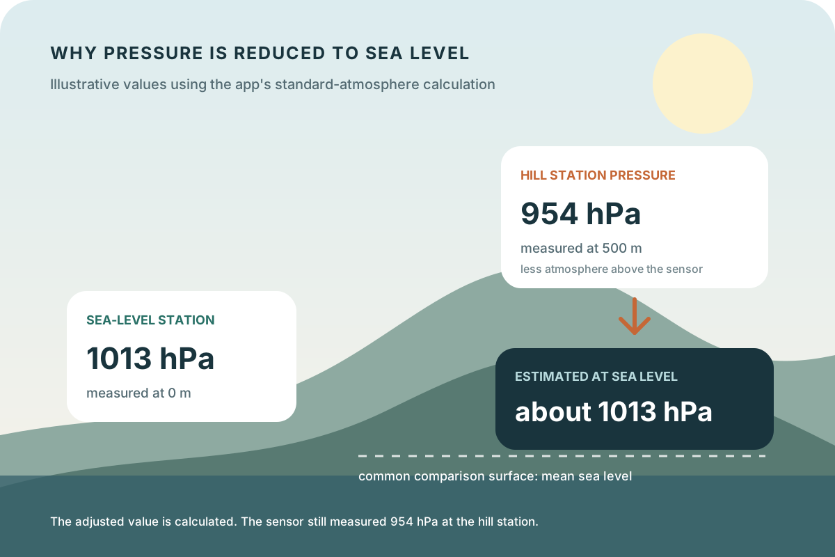
Why pressure is reduced to sea level
Pressure decreases with height because less of the atmosphere is above the instrument. If a regional weather map plotted only station pressure, mountain stations would almost always look like lows and coastal stations would look comparatively high, even under the same broad pattern.
A sea-level reduction estimates the pressure at a shared elevation. This lets forecasters draw regional highs, lows, and isobars around atmospheric patterns rather than simply tracing terrain. The adjusted result is often called mean sea-level pressure, MSLP, or pressure reduced to sea level.
Key takeaways
- Station pressure is measured at the instrument; sea-level pressure is calculated for comparison.
- Reducing values to sea level prevents terrain from dominating regional pressure maps.
- Altitude input and calculation method matter, so two adjusted values may differ slightly without either raw sensor being faulty.
A worked example from the app's calculation
Barometer applies a standard-atmosphere approximation to the device pressure and altitude. Using that formula, an illustrative measurement of 954 hPa at 500 metres produces about 1012.6 hPa at sea level, displayed as roughly 1013 hPa when rounded to a whole hectopascal. The calculation adds context; it does not alter what the sensor physically measured at 500 metres.
At sea level, the correction approaches zero, so a 1013 hPa station reading remains about 1013 hPa after normalization. The diagram uses these simple examples to isolate elevation. They are not simultaneous observations and do not imply that every location at 500 metres should read 954 hPa.
| Measured pressure | Altitude | Estimated sea-level pressure |
|---|---|---|
| 1013 hPa | 0 m | 1013 hPa |
| 954 hPa | 500 m | 1012.6 hPa |
| 900 hPa | 1000 m | 1014.6 hPa |
Why two sea-level values may not match exactly
The pressure between an elevated station and sea level cannot be measured at the station because that column of air is below the instrument. A reduction method must estimate it. Barometer uses a standard-atmosphere relationship; a weather service may incorporate station temperature, established station elevation, or a different operational method.
Altitude is another input. A phone's altitude estimate can change with location data and sensor availability, while an official station uses a surveyed or documented elevation. Differences in time, location, rounding, and sensor accuracy also contribute. A small mismatch is not enough to conclude that either source is wrong.
How to compare the app with a weather map
First confirm that the external source reports sea-level pressure rather than station, surface, or altimeter pressure. Match units, then compare the nearest available place and the same observation time. A forecast valid for later today is not expected to equal a sensor measurement from now.
Use the comparison to check broad agreement in level and direction, not to force every decimal to match. The regional map adds spatial context, while Barometer's on-device history shows how the local estimate evolved between saved measurements.
What sea-level pressure does not tell you
Sea-level pressure does not describe the exact pressure surrounding your body or device at elevation; station pressure does. It also does not reveal altitude, wind, precipitation, lightning, or visibility by itself. A value above or below 1013.25 hPa is not a complete weather forecast or a safety classification.
Read the number as one layer of context. Pair its recent trend with the official forecast and current conditions, and follow weather or marine warnings regardless of what the barometer shows.
Use 1013.25 hPa as a reference, not a universal cutoff
Check the pressure forecast separately from measured history