Use the trend before you leave the trailhead
Begin with the forecast and current park or trail alerts. The National Park Service's Hike Smart guidance recommends checking weather before departure, preparing for severe weather, and keeping a Plan B. A trailhead pressure reading comes after those checks and supplies only a local baseline.
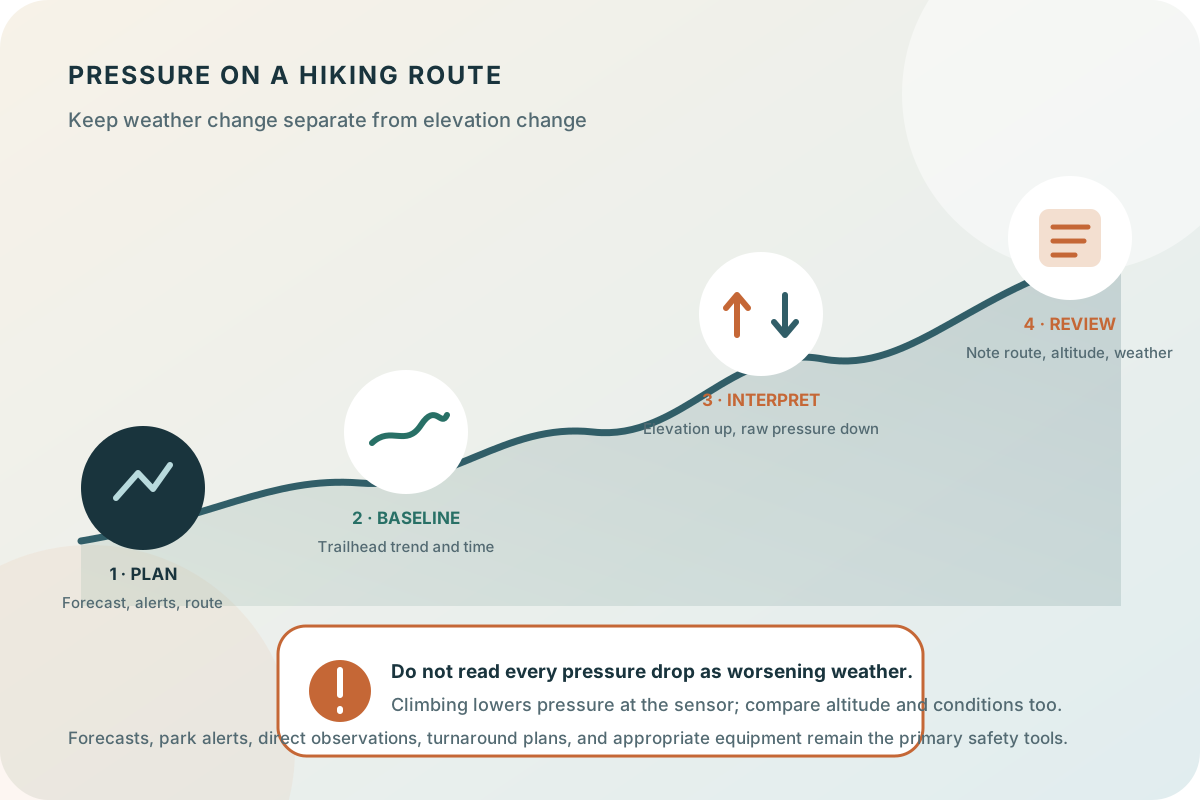
At the trailhead, use a consistent elevation and read direction, amount of change, and time interval. The useful question is not whether the number is universally high or low, but whether the recent local pattern agrees with or complicates the forecast and route plan.
Separate elevation change from weather change
Air pressure normally decreases as elevation increases. If you climb from a valley trailhead toward a ridge, station pressure at the phone can fall even when the larger weather pattern is steady. Descending can make it rise. That is why a raw pressure curve collected across changing elevation cannot be interpreted like a stationary weather-station record.
The app's sea-level estimate uses altitude to make readings at different elevations more comparable, but it remains an estimate and should not be treated as a mountain-weather forecast. Note meaningful elevation changes and compare the graph with the sky, wind, visibility, temperature, clouds, and precipitation you actually encounter.
Let direct hazards and your turnaround plan decide
Pressure must not persuade you to continue when direct conditions are deteriorating. Mount Rainier National Park's hiking safety guidance advises checking the forecast, watching for darkening skies, increasing wind, thunder, and lightning, and turning around when clouds or fog move in on an ascent. Those observations and local safety instructions take priority over the graph.
Set route-specific limits before leaving: turnaround time, acceptable visibility, escape options, weather thresholds, and the capability of the group. Pressure can prompt another review, but it should not create permission to extend the plan.
Key takeaways
- Check the weather forecast, park or trail alerts, and route hazards before using pressure as added context.
- Climbing normally lowers pressure at the sensor, so a raw drop during an ascent is not automatically a weather signal.
- Direct observations and a conservative turnaround plan matter more than a phone reading.
- Notes are most useful when they include route, elevation change, time, and observed conditions.
Use the offline record to review the hike
Coverage comes and goes on many routes. The phone can retain its on-device pressure history without a fresh forecast download, but that does not make the history a substitute for communication, navigation, emergency equipment, or forecast access planned for the route.
After the hike, save a short note with the route, approximate elevation change, timing, and observed weather. This makes the curve interpretable later: you can distinguish an ascent-related pressure change from a stationary pre-hike trend and remember why you continued, changed route, or turned around.